As part of St. Croix Electric Cooperative’s commitment to technology and information upgrades, contractors from Global Mapping Solutions (GMS) continue the project they began last fall, accessing electric poles, meters (yes, SCEC owns the meter on your house), underground pad-mounted transformers (those big green boxes!) and enclosures while conducting their daily work – including on weekends.
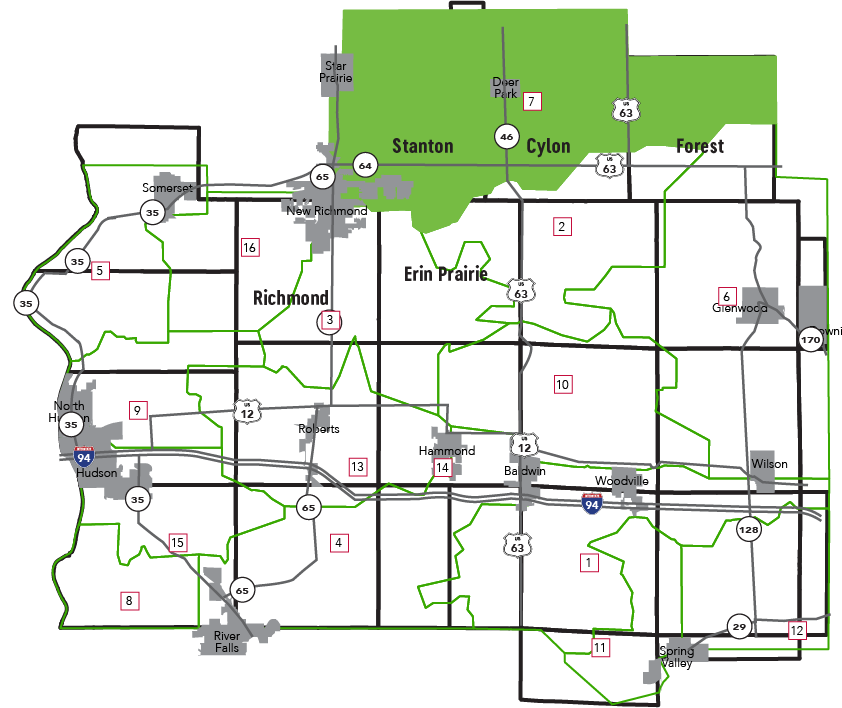
They are scheduled to move into the Cylon substation service territory early next week. (See map below for reference.) Members in the area will be notified by either email or letter as well as automated phone calls. Crews could remain in the area for up to 6 weeks.
GMS has been conducting GPS (Global Positioning System) field data collection for electric utilities for almost 25 years. Crews normally work in pairs wearing reflective vests and ball caps and accessing SCEC facilities using ATVs, pickup trucks and sometimes on foot. They will be equipped with GPS and tablet computers and will also be using digital cameras to take pictures of equipment.
During the collection process, GPS software defines the spatial references (latitude and longitude) of the information collected. The entire data collection can be downloaded and converted into a Geographic Information Systems (GIS) file and be used compatibly with our mapping software.
What does this mean for you?
Having all the information in our mapping system up to date means – among other things – we will be able to respond even more efficiently and safely to power outages … and, in turn, we will be able to communicate even more effectively with you about them.